Skip to content
recaplica

    One moment: security check

    Cloudflare wants to make sure you're not a robot. Tick the box below and your search will continue on its own.

    IT
    recaplica What Is a Flood? Causes, Types and Flash Floods
    © 2026 Recaplica · recaplica.com — All rights reserved
    Home › Science

    What Is a Flood? Causes, Types and Flash Floods

    By Recaplica Newsroom · Updated on October 22, 2026

    What to print

    Page numbers appear when printing with default margins.

    Slides

    Choose a cut

    Flash10 slidesThe essential thread, to present in classFull15 slidesEvery chapter and the deeper detail

    Both come with speaker notes.

    Telegram channel
    recaplica Clear in 30 seconds, yours in 10 minutes.
    In 30 seconds Key points Figures Deep dive Slides Myths Mind map Quiz Flashcards FAQ

    In 30 seconds quick read

    A flood is water covering, for a while, land that is normally dry. Heavy or prolonged rain usually sets it off by swelling rivers, streams, canals and sewers. When a swollen river spills over its banks or breaks through them, the land around it goes under water. Many Italian river basins are small and react to rain within hours, so Italy also gets flash floods, after intense, localised rain that is hard to forecast.

    Key Points

    • The 2007 EU Floods Directive counts as a flood any temporary flooding of normally dry land, whether the water comes from rivers, mountain torrents or the sea.
    • Italy's Io non rischio campaign separates two moments: the river spills over or breaks its banks, and then the water covers the land nearby.
    • Ground that is already wet absorbs less rain, and land sealed under asphalt and concrete sends more water to rivers, faster.
    • Large rivers rise slowly and can be tracked; small rivers and mountain streams build up within hours and leave little time to react.
    • According to the USGS, a “100-year flood” has a 1% chance of happening in any given year, even if one has just occurred.
    • In ISPRA data processed in 2020 and carried in its 2024 report, 11.5% of Italy's residents, 6.8 million people, live where water can reach under the medium hazard scenario.

    Key figures

    • 6.8 million residents of Italy living in floodable areas under the medium hazard scenario, 11.5% of the population (data processed in 2020) Source: ISPRA, Rapporti 356/2021, carried in the report on hydrogeological instability in Italy, 2024 edition (Rapporti 415/2025)
    • 5.4% of Italy's land area at high flood hazard, 16,224 square kilometres, in the 2020 national compilation of flood maps Source: ISPRA, compilation version 5.0 of 2020 (Rapporti 356/2021)
    • 23 rivers and streams overflowed in Emilia-Romagna in the events of 2-3 and 16-17 May 2023, with 45 municipalities hit in 3 provinces Source: Emilia-Romagna Region, 2020-2024 end-of-term report

    Deep Dive

    What is a flood?

    According to the EU Floods Directive, signed in Strasbourg on 23 October 2007, a flood is the temporary covering by water of land that is normally dry. The water may come from a river, a mountain torrent, one of the Mediterranean streams that flow only at certain times, or the sea along the coast. Flooding from sewer systems can be left out of the definition. ISPRA, Italy’s national institute for environmental research, works from the same idea and also names canals and lakes.

    The directive starts from the premise that floods are natural events and that nobody can prevent them. European law therefore deals with “flood risk”, which combines two things: how likely an event is and how much harm it could do to people, the environment, cultural heritage and the economy.

    Italy’s Civil Protection Department describes a flood from the river’s point of view. Once the banks can no longer contain the water, it spreads out all around and reaches homes, factories, roads and farmland.

    Flood definition: the river overflows, the land goes under

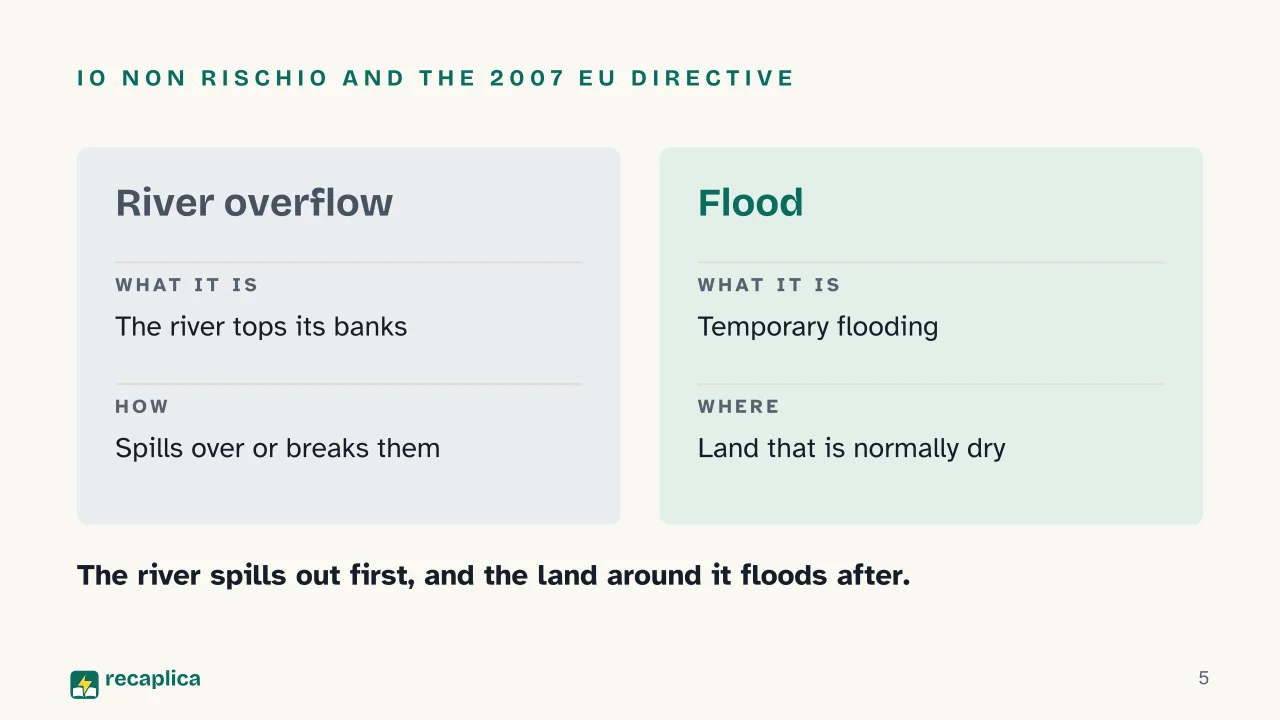
    English uses one word, flood, for the whole event. The Io non rischio campaign, run by Italy’s Civil Protection Department, splits it into two moments. First the river, swollen by rain, spills over its banks or breaks through them; then the area around it is flooded, and that flooding is the flood proper.

    Sea water belongs in the picture too. ISPRA describes coastal flooding when the sea moves inland, as it did along the coast of the Marche and Emilia-Romagna in May 2023, and the European definition of a flood already covers water arriving from the sea. In these sources, overflow means only the river topping or breaking its banks.

    TermWhat it describesAn example from the sources
    River overflowThe swollen river spills over its banks or breaks through them23 rivers and streams overflowed in Emilia-Romagna, May 2023
    FloodTemporary covering by water of land that is normally dry45 municipalities hit in 3 provinces in the same event
    Coastal floodingLand along the coast under water from the seaThe coastal flooding in the Marche and Emilia-Romagna, 2023

    From rain to river: how a flood forms

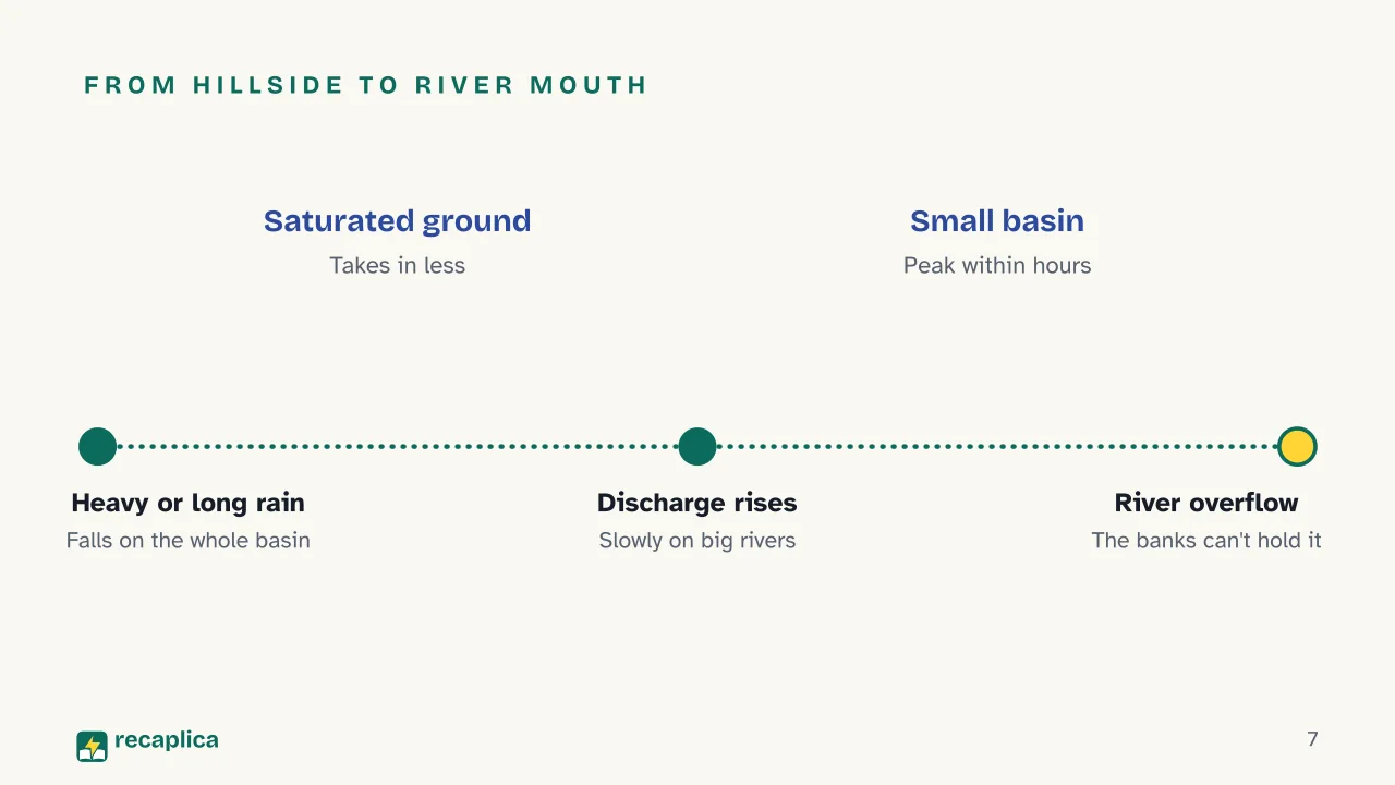
    According to Io non rischio, most floods start with heavy or prolonged rain, which can sharply increase the flow of rivers, streams, canals and sewers. The USGS calls that flow discharge: the volume of water passing a point on a river in a given time.

    Every river collects the water of its drainage basin, which English also calls a watershed or a catchment. The EU Water Framework Directive of 2000 defines it as all the land whose surface water flows, through streams, rivers and sometimes lakes, to a single mouth at the sea. Rain that lands on a distant hillside ends up in the same channel.

    How much of that water actually reaches the river depends on the ground. The USGS, the United States Geological Survey, explains that dry soil lets more rain soak in, while soil already wet from earlier rain absorbs less and sends more to the stream. In the largest floods the ground is saturated, and nearly all the water runs over the surface, on pavement and soaked soil alike.

    Human causes come on top. According to the Civil Protection Department, floods have become more frequent partly because so much of the land is built over and sealed under impermeable surfaces, so rain barely gets into the ground and more of it reaches the rivers, faster. The department also points to poorly cleared rivers, where debris and vegetation in the channel obstruct the current. The 2007 directive adds homes and businesses built on the plains next to rivers, land use that holds back less water, and climate change, all of which help make floods more likely and their damage worse.

    Practical example: in May 2023 Emilia-Romagna was hit by two waves of rain less than twenty days apart, and in several places the total for the month passed 450 millimetres. Across the two events of 2-3 and 16-17 May, the regional government reports, 23 rivers and streams overflowed and 45 municipalities in 3 provinces were hit. The basins on the ridge and in the hills around Forlì had received up to 300 millimetres in 48 hours, and ISPRA’s 2024 report counts more than 80,000 landslides in the region that month.

    River floods: large rivers and small streams

    Floods do not all rise at the same speed. Io non rischio notes that floods on large rivers build slowly and can be tracked and forecast, while those on small rivers and mountain streams climb very fast and leave little time to act. The USGS ties this to basin size: rivers with larger basins need longer spells of rain before they rise significantly.

    Italy, the Civil Protection Department points out, generally has small drainage basins that react to rain very quickly. Little time may pass between the first drops and the arrival of the flood peak. During summer downpours in particular, streams and minor watercourses can go from dry to full flood in moments, even after a thunderstorm that broke further upstream.

    Some watercourses in southern Italy only turn into real rivers after heavy rain. Then there are culverted streams, which run for long stretches beneath roads or buildings; like sewers, they cause flooding when they cannot carry away the excess rain.

    Flash floods: when the water arrives within hours

    NOAA, the US National Oceanic and Atmospheric Administration, defines a flash flood as one caused by very heavy rain over a short time, generally less than six hours. It can arrive anywhere from minutes to a few hours after the storm.

    In Italy, according to the Civil Protection Department, floods in small basins are common, especially in Liguria and Calabria, where a flood can form within hours of intense, localised rain. That kind of rain is hard to forecast, and it can also set off mudflows. Io non rischio adds that weather forecasts give the probability of rain over a wide area, not a promise that it will rain on one particular spot.

    A flash flood can even strike without any rain at all. NOAA lists a failed levee or dam and the sudden release of water held back by debris or ice. Burned land is highly exposed as well: after a wildfire, rain that soil and plants would normally have taken up runs off almost at once, and streams rise sooner and higher.

    TypeWhat happensCauses listed by NOAA
    River floodThe river level rises over its banksExcessive rain from tropical storms, thunderstorms that keep hitting the same area, rain on melting snow, ice jams
    Flash floodThe water arrives minutes to a few hours after the rainVery heavy rain over a short time, generally less than six hours
    Coastal floodLand along the coast goes under waterA high tide above the usual level, made worse by heavy rain and wind blowing in from the sea

    The return period and the “100-year flood”

    Hazard is measured with the return period, also called the recurrence interval: the average number of years between two floods of a given size. The USGS warns that real intervals vary widely and that an estimate needs at least ten years of records, becoming more reliable as the years add up.

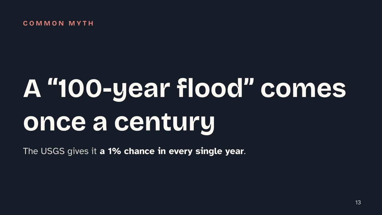
    A “100-year flood” does not come once a century. The USGS defines it as a flood with a 1% chance of happening in any given year, and over a million years an event like that would be expected about 10,000 times, at irregular intervals. Nor does a “100-year” rainstorm necessarily produce a “100-year” flood. What also matters is how much of the basin the rain covers, how wet the ground already is, and how the length of the storm compares with the size of the basin.

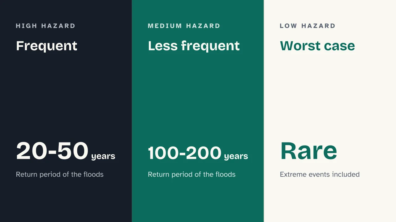
    Italy’s flood maps follow three scenarios set by Legislative Decree 49 of 2010, the law that brought the EU directive into Italian law. High hazard means frequent floods, with a return period of 20 to 50 years; medium hazard means less frequent floods, every 100 to 200 years; low hazard covers rare or extreme events. In ISPRA’s 2020 national compilation of these maps, high flood hazard areas cover 16,224 square kilometres, 5.4% of the country. Medium hazard areas cover about 30,200 square kilometres, 10%, and low hazard areas 42,376 square kilometres, 14%.

    Flood examples from Italy

    Among Italy’s worst floods for deaths and damage, the Civil Protection Department lists the Po in the Polesine in 1951, the Arno in 1966 and the Po across northern Italy in 1994 and 2000.

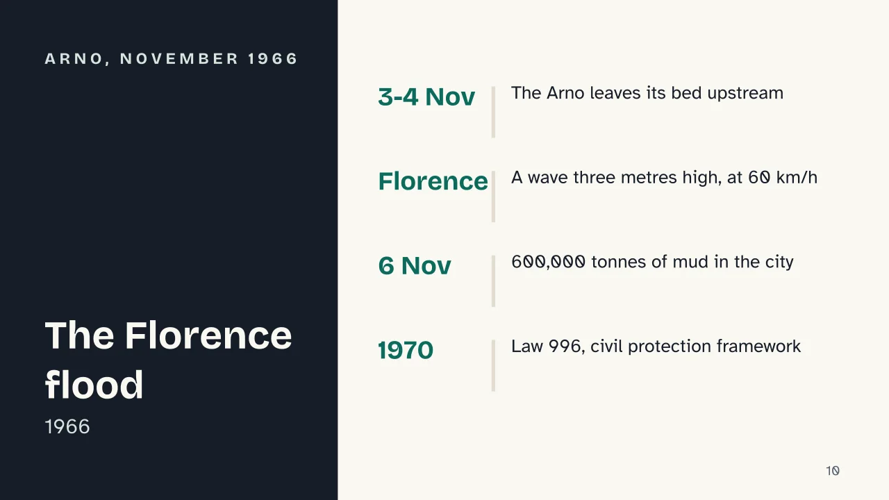
    Practical example: ten days of heavy rain came first. On the night of 3 to 4 November 1966 the Arno left its bed upstream, in the Casentino and the upper Valdarno, before it had even reached Florence. In the city, the Civil Protection Department writes, the flood wave stood three metres high and moved through the streets at 60 kilometres an hour. No monitoring network existed along the river, so nobody announced the overflow and Florentines were caught unprepared. A plaque in Via dei Neri, in the Santa Croce district, marks the highest water level, 4.92 metres. The department reports 35 deaths in Tuscany; on 6 November, when the river withdrew, Florence lay under 600,000 tonnes of mud. Law 996 of 1970 drew up an overall framework for civil protection in Italy and, for the first time, gave formal recognition to volunteers.

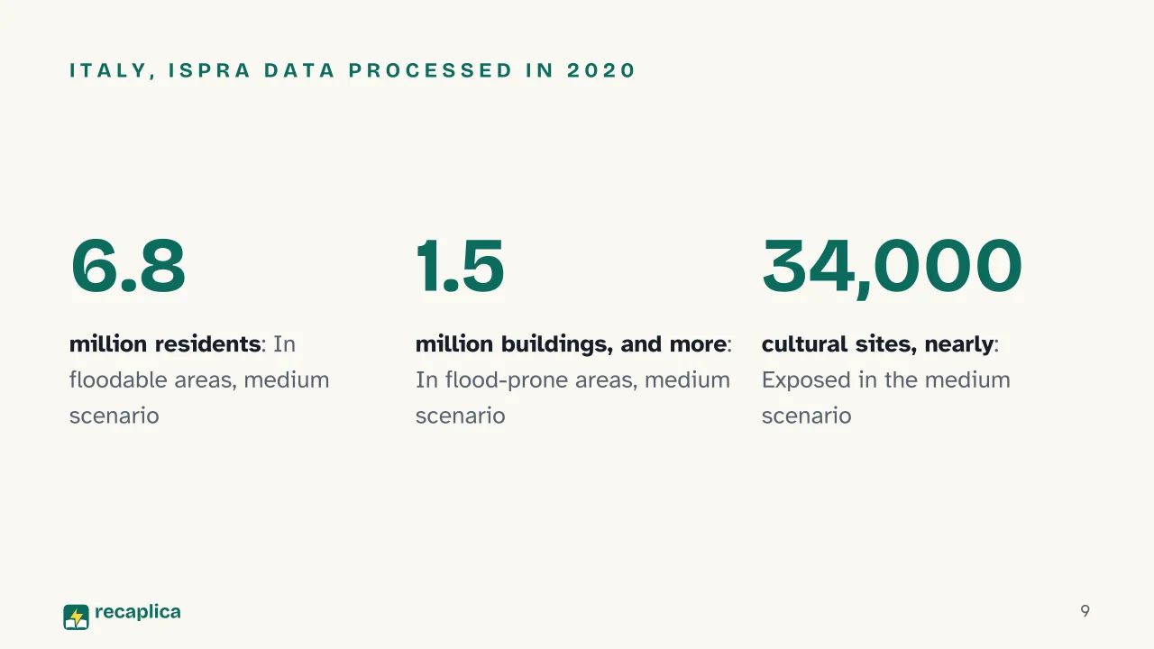
    ISPRA data processed in 2020, and carried in its 2024 report on hydrogeological instability in Italy, put 6.8 million people, 11.5% of residents, inside the zones that would flood in the medium hazard scenario, and count 2.9 million households exposed to flood risk. More than 1.5 million buildings stand in flood-prone areas in the medium scenario, 10.7% of all buildings in Italy, and nearly 34,000 cultural heritage sites are exposed in the same scenario. The regions with the most residents exposed to landslides and floods, adding the two risks together, are Emilia-Romagna, Tuscany, Veneto, Campania, Lombardy and Liguria. Io non rischio says the worst consequences come in cities, which hold more people and buildings and where changes made to the land often make floods more dangerous. The campaign adds that places that have flooded before are likely to flood again.

    Italy’s Civil Protection Department counts floods among hydrogeological hazards, together with landslides, avalanches, coastal erosion and ground subsidence. In 2024, according to ISPRA, 94.5% of Italian municipalities had at least one area at risk from one of these hazards, ground subsidence excepted.

    Climate and cities: what the IPCC says

    The IPCC, the UN body that assesses climate science, states with high confidence in its 2021 report that heavy rainfall has become more frequent and more intense since the 1950s over most land areas with enough data. It judges it likely that human-caused climate change is the main driver. In its projections, extreme daily rainfall worldwide grows about 7% more intense for each extra degree of warming (high confidence).

    At 1.5 °C of global warming, the IPCC projects heavier and more frequent intense rainfall, with the floods that come with it, in most regions of Africa and Asia, with high confidence. For Europe the same projection carries medium confidence. Along coasts, rising sea level makes flooding in low-lying areas more frequent and more severe (high confidence). Cities count here as well: urbanisation increases rainfall over and downwind of built-up areas (medium confidence) and the intensity of surface runoff (high confidence).

    Flood defences, alerts and safety advice

    The Civil Protection Department sorts defences into two groups. One is engineering works such as embankments, basins that hold water back, channels that divert excess floodwater and straightened riverbeds; the other is non-structural measures, meaning land management, warning systems and emergency plans. The EU directive required each member state to complete flood hazard and risk maps by 22 December 2013 and to publish flood risk management plans by 22 December 2015.

    In Italy, alerts are issued by the regions and autonomous provinces, coordinated by the Civil Protection Department, and mayors then activate municipal plans. The national table, set on 10 February 2016, gives each level of criticality a colour: green for none, yellow for ordinary, orange for moderate and red for high. For thunderstorms the top level is orange, because red-level conditions already fall under the red alert for hydrogeological risk.

    During a flood, Io non rischio explains, water can rise suddenly by one or two metres within a few minutes. Indoors the danger is greatest below street level and on the ground floor. Outdoors, the campaign singles out underpasses, stretches near embankments and bridges, steep roads and the lowest ground around. The campaign advises against going down to a cellar or garage to rescue belongings and against heading out to move the car. In its guidance, people on the ground floor go up to higher floors by the stairs, since a lift can get stuck. Tap water could also be contaminated.

    The US National Weather Service puts figures on the force of moving water. About 6 inches of fast water can knock an adult over, about 12 inches can carry away most cars and about 2 feet can sweep off SUVs and pickup trucks: roughly 15, 30 and 60 centimetres.

    Slide deck

    Slides ready to download and make your own in PowerPoint or Google Slides, with speaker notes. Pick the Flash cut or the Full one.
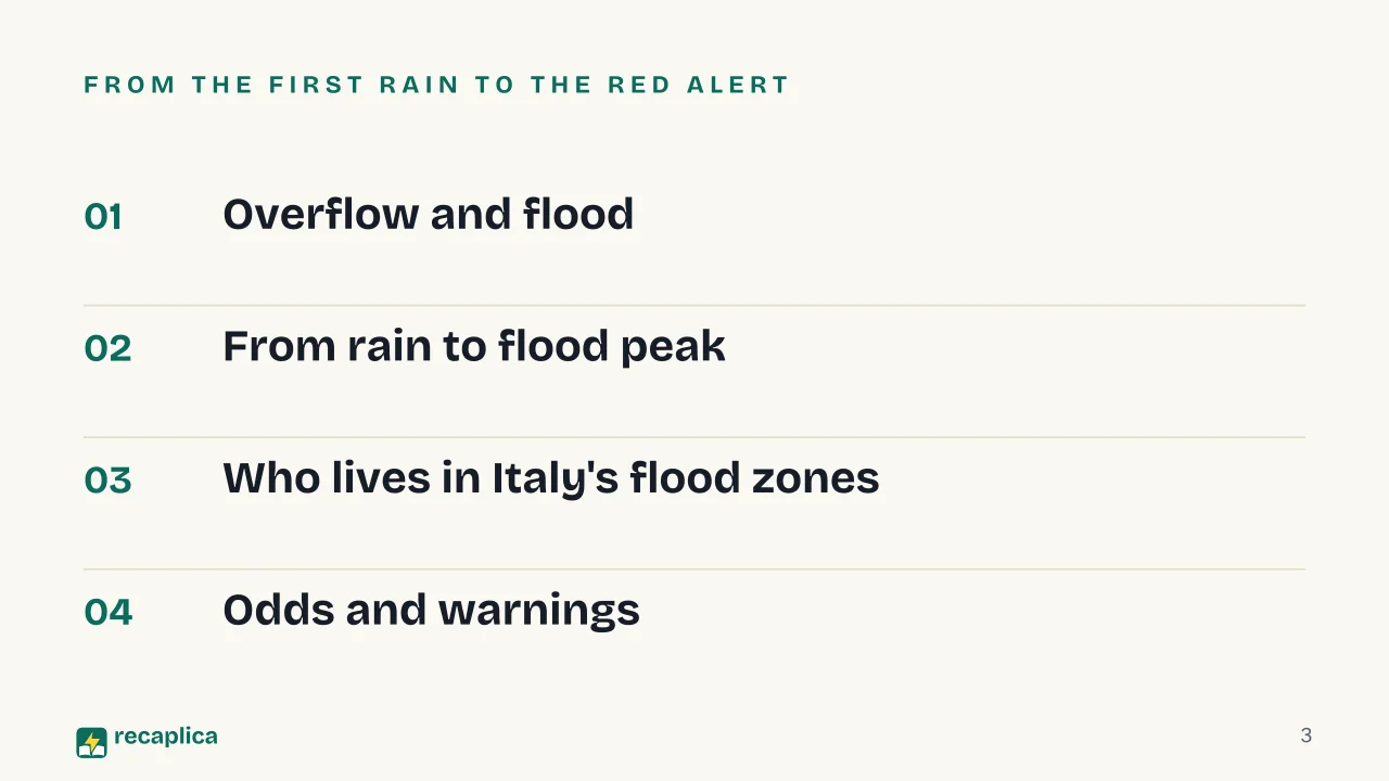
    Slide 1 of the presentation on What Is a Flood? Causes, Types and Flash Floods: FloodSlide 2 of the presentation on What Is a Flood? Causes, Types and Flash Floods: Why does a river burst its banks?Slide 3 of the presentation on What Is a Flood? Causes, Types and Flash Floods: From the first rain to the red alertSlide 4 of the presentation on What Is a Flood? Causes, Types and Flash Floods: Chapter 01: Overflow and floodSlide 5 of the presentation on What Is a Flood? Causes, Types and Flash Floods: Io non rischio and the 2007 EU directiveSlide 6 of the presentation on What Is a Flood? Causes, Types and Flash Floods: Chapter 02: From rain to flood peakSlide 7 of the presentation on What Is a Flood? Causes, Types and Flash Floods: From hillside to river mouthSlide 8 of the presentation on What Is a Flood? Causes, Types and Flash Floods: Chapter 03: Who lives in Italy's flood zonesSlide 9 of the presentation on What Is a Flood? Causes, Types and Flash Floods: Italy, ISPRA data processed in 2020Slide 10 of the presentation on What Is a Flood? Causes, Types and Flash Floods: Arno, November 1966Slide 11 of the presentation on What Is a Flood? Causes, Types and Flash Floods: Chapter 04: Odds and warningsSlide 12 of the presentation on What Is a Flood? Causes, Types and Flash Floods: Frequent · Less frequent · Worst caseSlide 13 of the presentation on What Is a Flood? Causes, Types and Flash Floods: A “100-year flood” comes once a centurySlide 14 of the presentation on What Is a Flood? Causes, Types and Flash Floods: According to NOAA, over how long does the rain behind a flash flood usually fall?Slide 15 of the presentation on What Is a Flood? Causes, Types and Flash Floods: Concept map, quiz and flashcards online
    Flash10 slidesThe essential thread, to present in classFull15 slidesEvery chapter and the deeper detail

    Common myths

    • ✗ Myth A “100-year flood” comes once a century, so after you have seen one you are safe for a long while.

      ✓ Reality The USGS defines it as a flood with a 1% chance of happening in any given year. The odds start again every year, and a rare flood last year does nothing to lower the chance of another this year. The return period is an average gap between floods of that size, and the real gaps vary a great deal.

    • ✗ Myth If it isn't raining where I am, the stream nearby can't fill up all of a sudden.

      ✓ Reality Italy's Civil Protection Department warns that a stream or small watercourse, especially in summer, can swell suddenly because of a storm further upstream, even if it was dry moments before. A stream gathers the water of its whole basin. NOAA adds that a sudden flood can also come when a levee or a dam fails.

    • ✗ Myth A car can get through a flooded road if the water is only a few centimetres deep.

      ✓ Reality The Io non rischio campaign explains that even a few centimetres of water can make a driver lose control or stall the engine, and people can end up trapped. The US National Weather Service estimates that about 12 inches of moving water, roughly 30 centimetres, is enough to carry away most cars. The road surface under the water may also have collapsed.

    Mind map

    Drag the background to move around and the nodes to reposition them; use − and + to collapse and expand branches.
    Customize
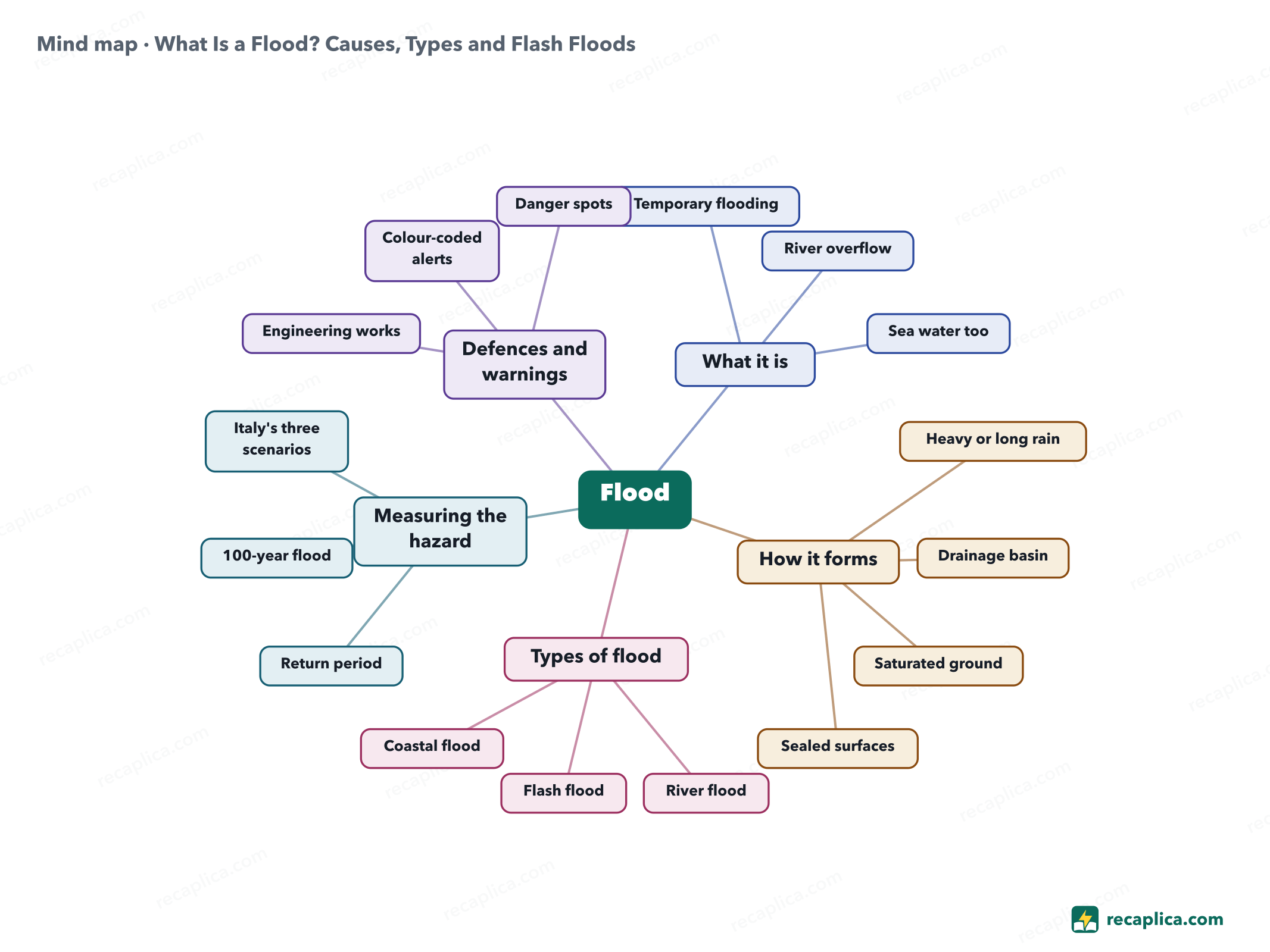
    Mind map: What Is a Flood? Causes, Types and Flash Floods
    • Flood
      • What it is
        • Temporary flooding Normally dry land under water, in the 2007 EU directive
        • River overflow The river spills over or breaks its banks
        • Sea water too Coastal flooding counts as a flood
      • How it forms
        • Heavy or long rain Raises the river's discharge
        • Drainage basin All the land that feeds water to the river
        • Saturated ground Takes in no more rain
        • Sealed surfaces More water reaches rivers, and sooner
      • Types of flood
        • River flood The river rises over its banks
        • Flash flood Very heavy rain, usually under six hours
        • Coastal flood Unusually high tide, rain and onshore wind
      • Measuring the hazard
        • Return period Average years between floods of similar size
        • 100-year flood 1% chance in any given year
        • Italy's three scenarios High, medium and low hazard, Decree 49/2010
      • Defences and warnings
        • Engineering works Embankments, detention basins, diversion channels
        • Colour-coded alerts Green, yellow, orange, red
        • Danger spots Cellars, underpasses, embankments and bridges

    Quiz: test yourself

    Answer the questions to check what you have learned: you get instant feedback and a short explanation.

    Grade 0/10 0/5
    1 According to Italy's Io non rischio campaign, what separates a river overflowing from the flood?

    Overflowing is what the river does when water tops its banks or breaks through them. The flood is the water that then spreads across the land around the river.

    2 What does the USGS mean by a “100-year flood”?

    It describes a yearly probability: over a million years, about 10,000 floods of that size would be expected, at irregular intervals.

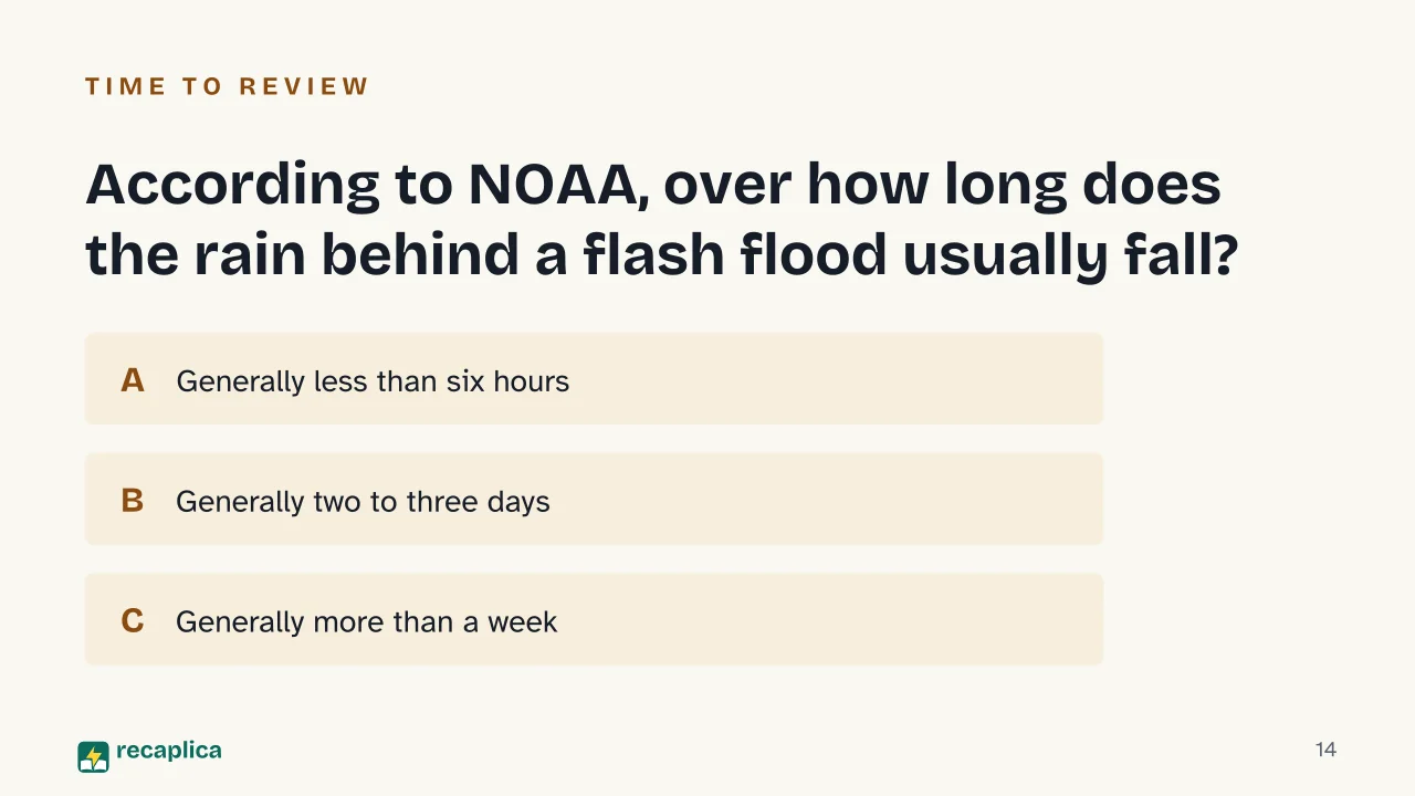
    3 According to NOAA, over how long does the rain behind a flash flood usually fall?

    What counts is how concentrated the rain is. For NOAA a very intense downpour lasting under six hours is enough, and the water can arrive minutes or a few hours later.

    4 Why can a flood peak arrive soon after the rain starts in Italy?

    Italy's Civil Protection Department notes that the country generally has small basins, which react to rain very quickly. Intense, localised rain can then bring mudflows and flash floods.

    5 True or false: ground already soaked by earlier rain sends more water to the river than dry ground.

    According to the USGS, rain gets into dry soil more easily. Soaked soil takes in less, and in the largest floods nearly all the water runs over the surface into the stream.

    Answers: 1-A · 2-B · 3-A · 4-B · 5-A

    Flashcards

    Tap the card to flip it and check whether you remember the answer, then move to the next one.

    1 / 7

    Explain it in your own words

    The ultimate test: if you can explain it in simple words, you've truly understood it. Write your explanation, then compare it with the Recap.

    Your explanation is saved only on this device.

    A flood is water covering, for a while, land that is normally dry. Heavy or prolonged rain usually sets it off by swelling rivers, streams, canals and sewers. When a swollen river spills over its banks or breaks through them, the land around it goes under water. Many Italian river basins are small and react to rain within hours, so Italy also gets flash floods, after intense, localised rain that is hard to forecast.

    Frequently asked questions

    Is a flood the same as a river overflowing its banks?

    They are two stages of one event. The overflow is the river leaving its channel; the flood is the surrounding land covered by water for a time. EU law also counts sea water reaching the land along the coast as a flood, so some floods have no river behind them at all.

    Why do rivers flood?

    Heavy or prolonged rain raises the discharge until the banks can no longer hold the water. The USGS explains that ground already wet from earlier rain sends more water to the river. Italy's Civil Protection Department adds land sealed under impermeable surfaces, and debris and vegetation in the channel that slow the current.

    What is a flash flood?

    A flash flood is caused by a very intense, short downpour: NOAA describes rain that generally lasts less than six hours. In Italy the Civil Protection Department reports them mostly in Liguria and Calabria, where small basins swell a few hours after localised rain.

    What do flood alert colours mean in Italy?

    In the Civil Protection Department's national table each colour stands for a level of criticality, running from green (none) through yellow (ordinary) and orange (moderate) up to red (high). The regions and autonomous provinces issue the alerts, and mayors then put their municipal civil protection plans into action.

    Sources

    • Direttiva 2007/60/CE relativa alla valutazione e alla gestione dei rischi di alluvioni (Unione europea)
    • Direttiva 2000/60/CE che istituisce un quadro per l'azione comunitaria in materia di acque (Unione europea)
    • ISPRA, Le alluvioni
    • ISPRA, Indicatori di rischio
    • ISPRA, Dissesto idrogeologico in Italia (presentazione del rapporto, luglio 2025)
    • ISPRA, Alluvione in Emilia-Romagna: piogge record, fiumi e corsi d'acqua esondati (maggio 2023)
    • ISPRA, Dissesto idrogeologico in Italia: pericolosità e indicatori di rischio, edizione 2024, executive summary (Rapporti 415/2025)
    • Regione Emilia-Romagna, Bilancio di mandato 2020-2024, Più forti delle emergenze
    • Dipartimento della Protezione Civile, Rischio meteo-idro: i fenomeni
    • Dipartimento della Protezione Civile, Descrizione del rischio meteo-idro
    • Dipartimento della Protezione Civile, Tabella delle allerte e delle criticità meteo-idrogeologiche e idrauliche
    • Dipartimento della Protezione Civile, The flood of Florence
    • Io non rischio, Alluvione
    • Io non rischio, Cosa sapere sull'alluvione
    • Io non rischio, Cosa fare in caso di alluvione
    • USGS Water Science School, 100-Year Flood
    • USGS Water Science School, Watersheds and Drainage Basins
    • NOAA National Severe Storms Laboratory, Severe Weather 101: Flood Types
    • NOAA National Weather Service, Turn Around Don't Drown
    • IPCC, Climate Change 2021: The Physical Science Basis, Summary for Policymakers

    Every Recap goes through an independent review before publication.

    Every evening, the day's new Recaps on our Telegram channel. Join the channel →

    Keep learning

    • Science What Is a Hurricane? How It Forms and How It Differs from a Cyclone or Typhoon A hurricane is a tropical cyclone: an area of low pressure with air circling it in a closed loop, counterclockwise in the Northern Hemisphere and clockwise in the Southern. Tropical cyclones form over seas of at least 80 °F (27 °C) and get their energy from the heat water vapor releases as it condenses into cloud. Once sustained winds reach 74 mph (119 km/h), the storm takes the name used in its region, hurricane in the North Atlantic and typhoon in the northwest Pacific. Below that threshold it is a tropical depression or a tropical storm, and above it the Saffir-Simpson scale rates its strength from 1 to 5. In the mid-latitudes the weather from autumn to spring comes from extratropical cyclones, which over the Mediterranean sometimes pick up tropical traits and become medicanes. Read the Recap →
    • Science What Is Frost and How Does It Form? Frost is the layer of ice crystals that appears on grass, cars and roofs on cold mornings. It forms through deposition, when water vapor in the air turns directly into ice without passing through a liquid stage first. This requires the surface itself to drop below 0°C, a condition that develops most easily on clear nights with light wind and no fog. Some surfaces frost earlier than others because they lose heat at different rates: grass faster than asphalt, glass and metal faster than most other materials. Frost should not be confused with rime, which forms when supercooled fog droplets freeze on contact with a surface exposed to wind. Read the Recap →
    • Science Energy Sustainability: What It Means and How to Achieve It Energy sustainability is the condition in which energy stays available, stays affordable and leaves a limited environmental footprint. The IEA, the international agency that studies energy systems, puts those three conditions in its stated mission, and the work runs along two lines, the sources energy is drawn from and the amount a given service requires. On the first, the IEA expects renewable capacity worldwide to grow by 4,600 GW between 2025 and 2030, with solar covering almost 80% of that. On the second, global energy efficiency should improve by 1.8% in 2025, while in the European Union Eurostat measured a renewable share of 26.2%, against a target of 42.5% by 2030. Read the Recap →

    recaplica

    Clear in 30 seconds, yours in 10 minutes.

    Recaps Mind maps Request a Recap Telegram channel Mind map maker Our method About Privacy & cookies Legal notes & terms of use

    © 2026 Recaplica · A project by Curi S.r.l. — VAT IT05472000750

    Statistics, only if you say so

    To learn which Recaps help most we would use Google Analytics, with aggregate, anonymous data. It starts only with your OK, and you can change your mind anytime. Privacy policy